Our Products

Precision Digital Agriculture System (PDAS) Platform

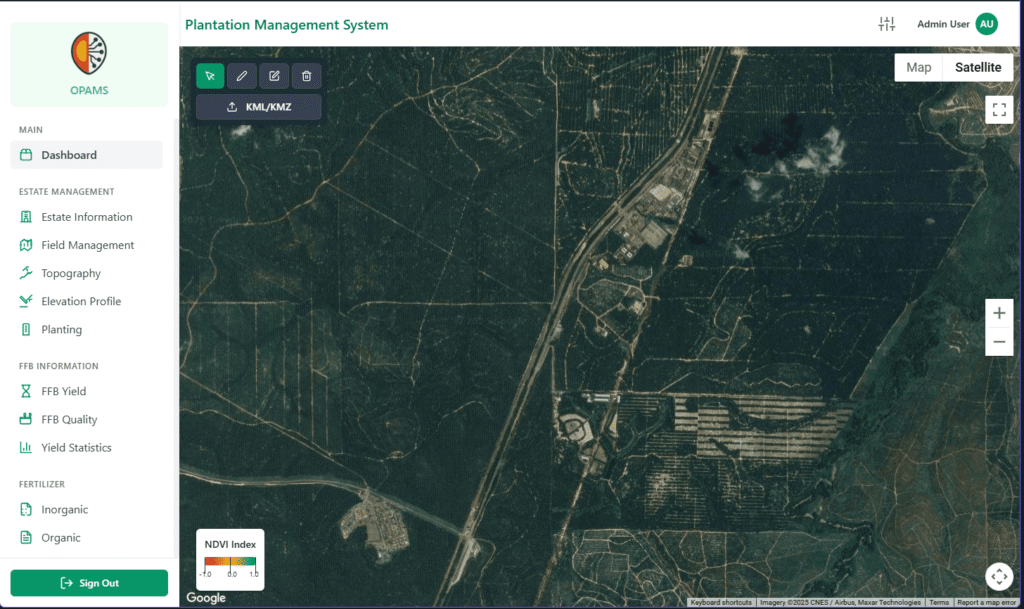
PDAS (Precision Digital Agriculture System) is a cloud-based digital agriculture platform that enables farmers and plantation operators to monitor, analyse, and manage their crops using satellite and drone imagery. The platform collects spatial data and processes it into practical information that supports daily operational and strategic decisions.

PDAS provides crop health monitoring through vegetation indices and time-series analysis, allowing users to detect early signs of stress, poor growth, or abnormal patterns across their fields. Instead of relying on manual inspections alone, plantation teams can use PDAS to identify priority areas for ground checks, fertilizer application, pest or disease management, and replanting decisions.

The platform also supports multi-estate and historical monitoring, helping managers compare performance across different locations and track changes over time. PDAS integrates smoothly with existing drone service providers and satellite data sources, requiring no hardware investment from users. Delivered as an online subscription service, PDAS is designed to be scalable, cost-effective, and suitable for precision agriculture in tropical plantation environments.

Reseller and Distributor of Fertilizer, Pesticide and Herbicide

In addition to the PDAS platform, we also act as a reseller and distributor of agricultural inputs such as fertilizers, pesticides, and herbicides. PDAS is used to generate data-driven recommendations on where and when these products should be applied, based on actual crop conditions observed from satellite and drone imagery.

By linking PDAS insights with input supply, we help plantations move from blanket application to targeted treatment. This improves input efficiency, reduces wastage, lowers operating costs, and delivers better crop outcomes. The integration of digital recommendations with product distribution creates a closed-loop precision agriculture ecosystem that benefits both growers and supplier

VTOL Drone Mapping

We also sell VTOL mapping drones for agricultural surveying and plantation monitoring. These drones are designed for large-area coverage and efficient data collection across plantations.

Data captured by the VTOL drones can be uploaded directly into the PDAS platform, where it is processed and analysed to generate crop health maps, risk zones, and actionable insights. This allows customers to not only own the drone hardware but also benefit from PDAS analytics, creating a complete solution from aerial data collection to decision-making.